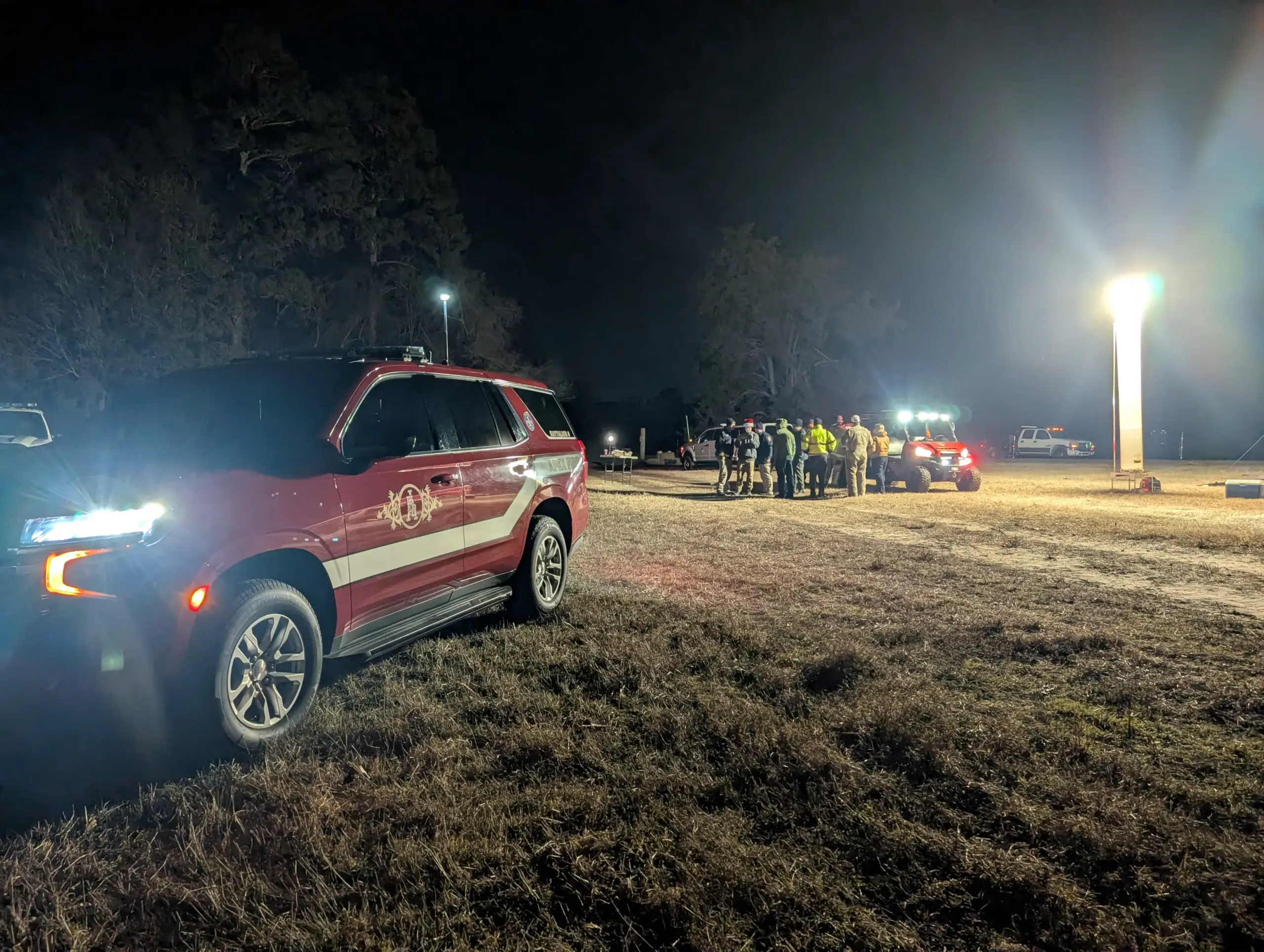
Public Safety & Emergency Support
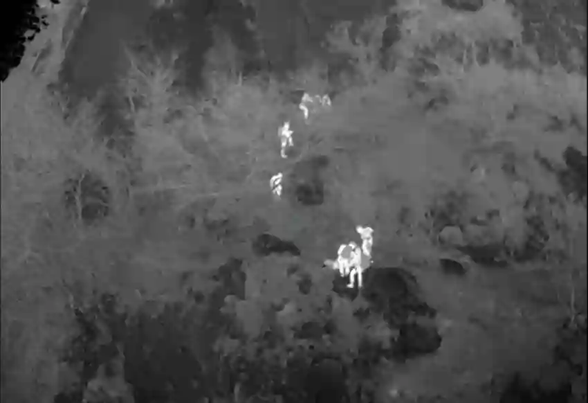
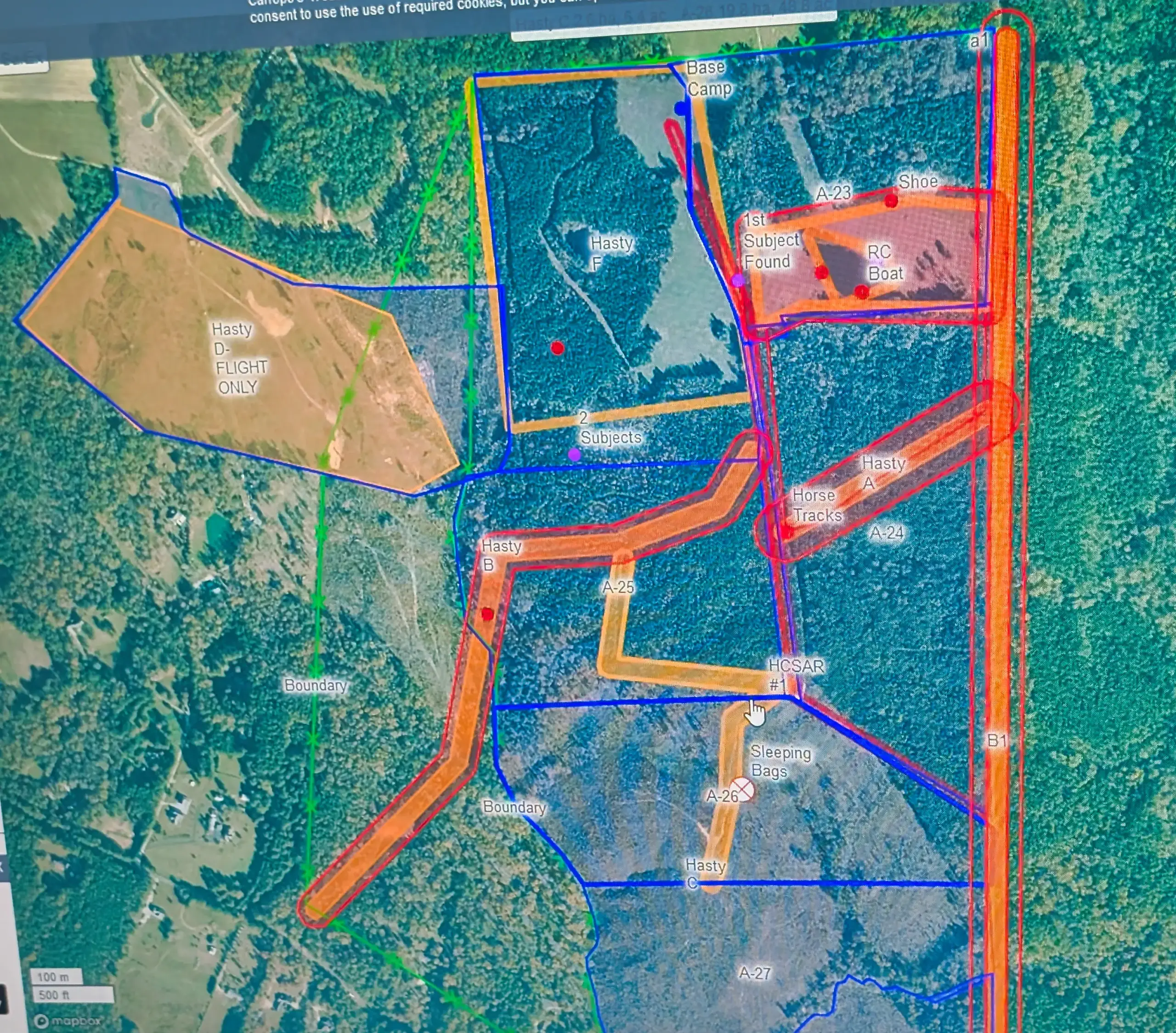
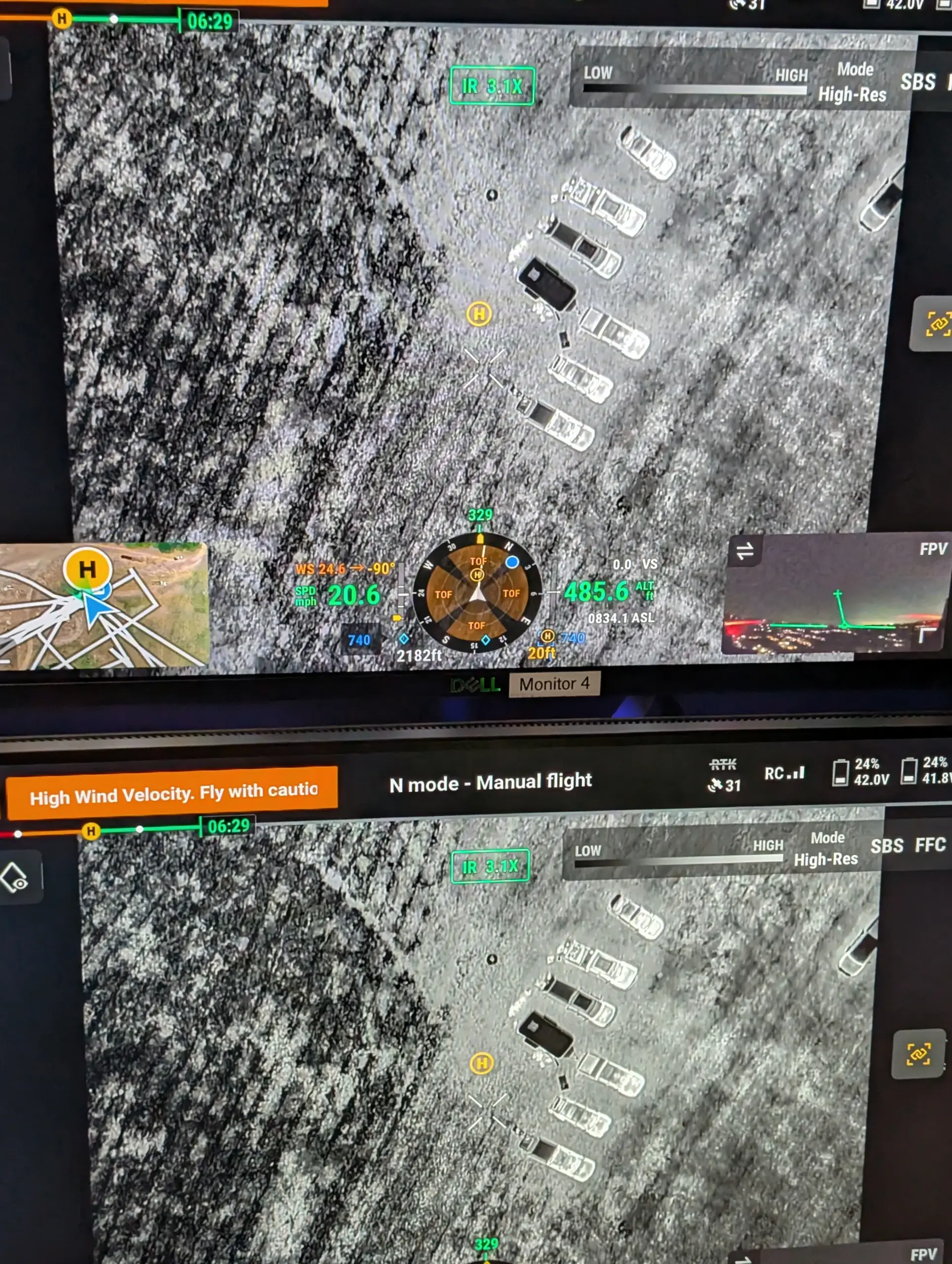
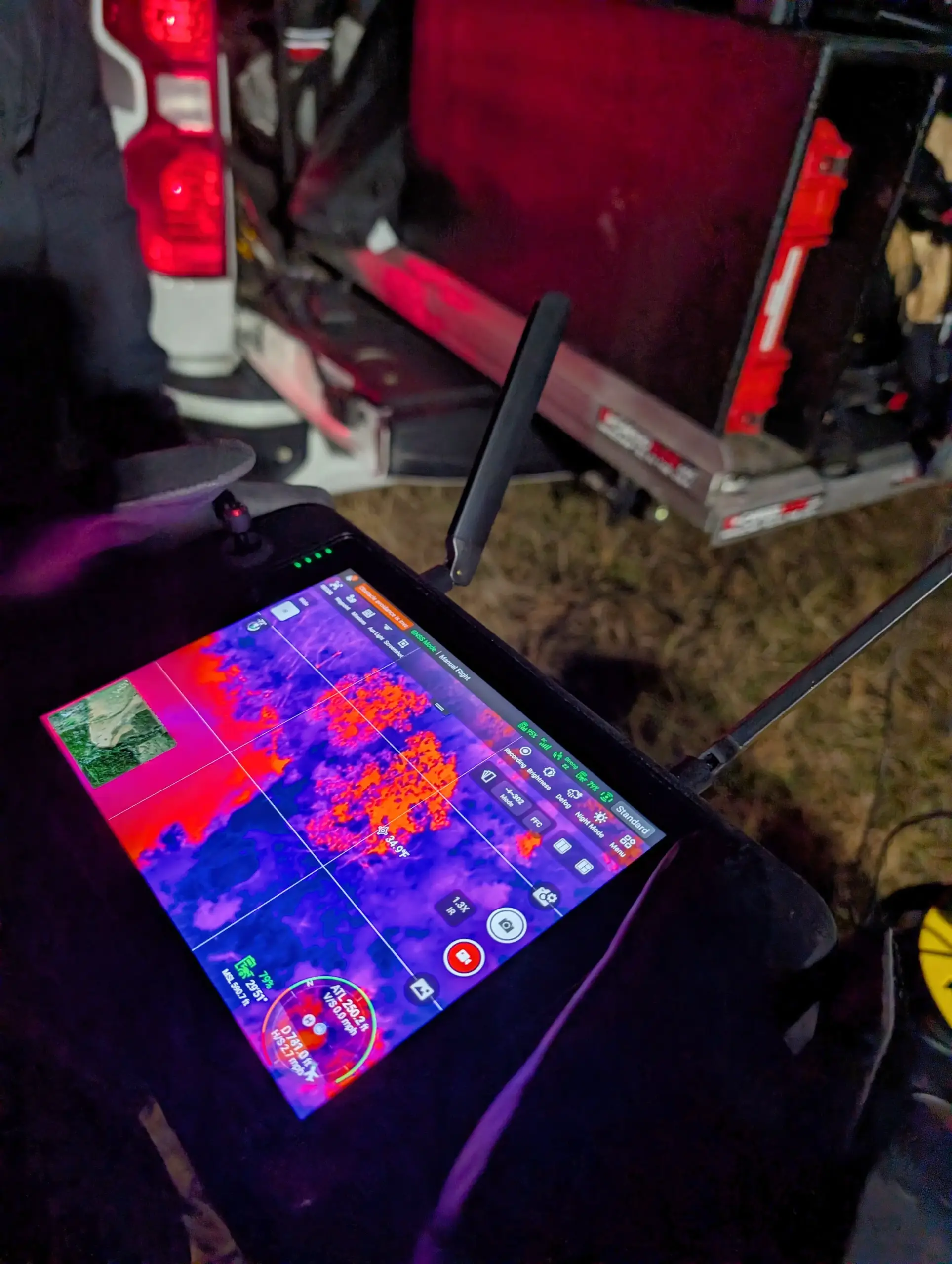
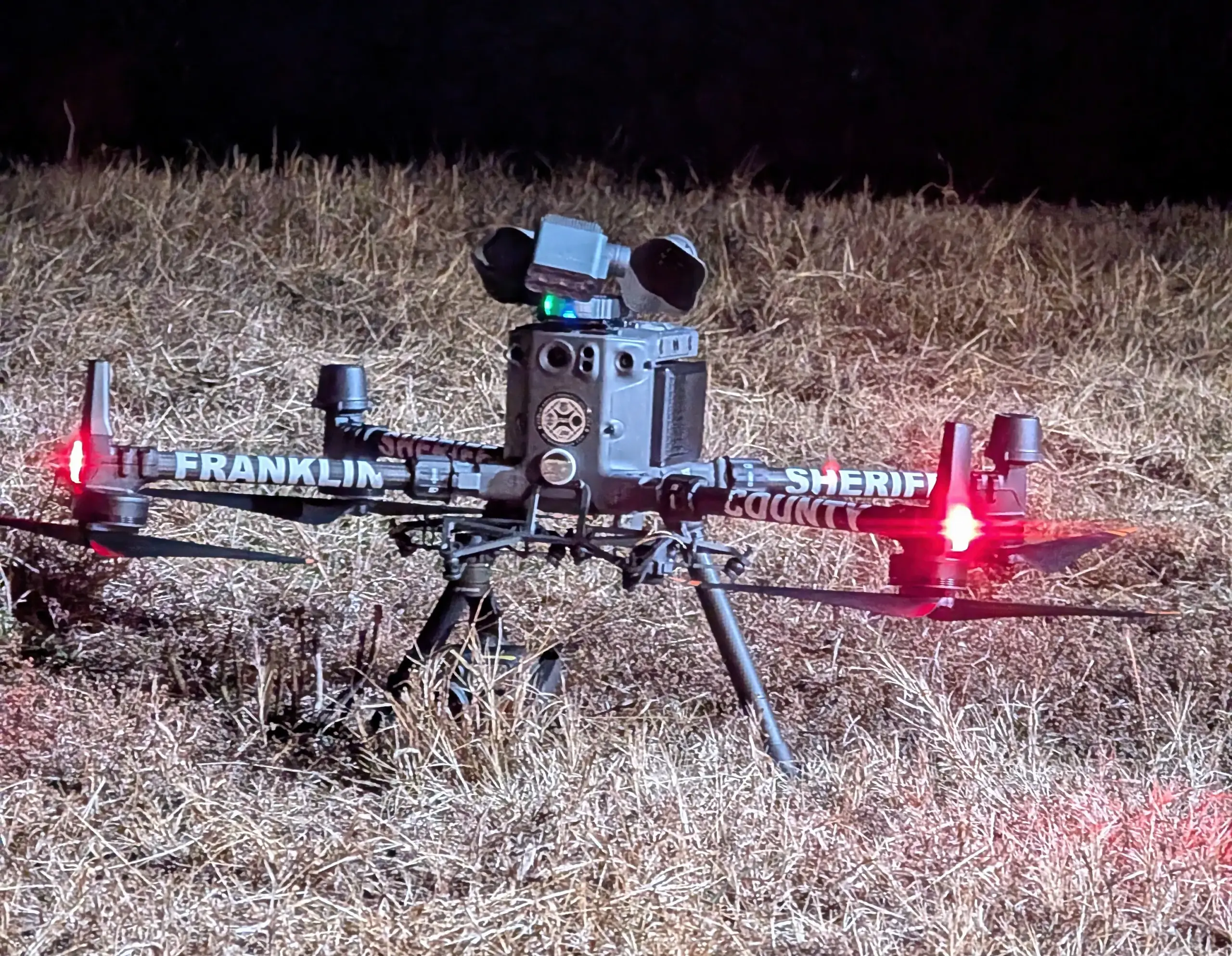
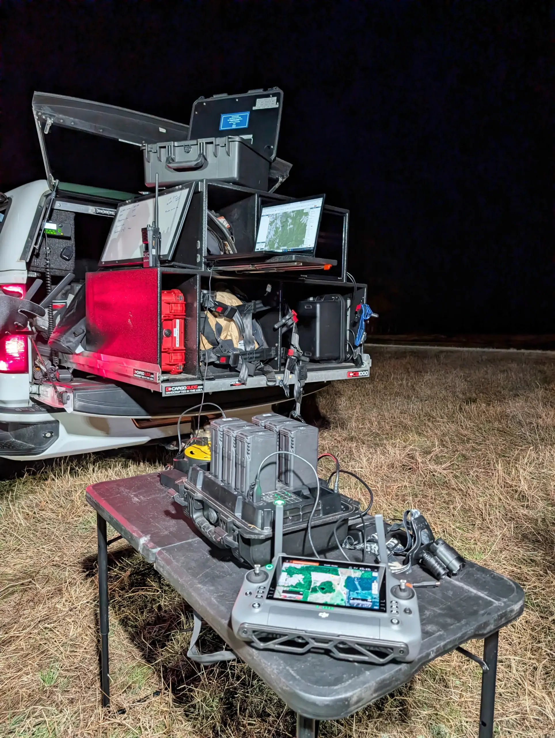
AGL provides aerial documentation in emergency and recovery environments when requested by authorized agencies or clients. High-resolution aerial and thermal imagery supports situational awareness, damage documentation, and post-event records in conditions where ground access may be limited or unsafe.
Important Notice:
AGL Drone Imagery LLC provides aerial documentation and visual data capture only. In active emergencies, always call 911 first so proper dispatch and command protocols are followed. AGL supports response and recovery efforts through visual documentation when activated by agencies or engaged by clients, but does not assume incident command or emergency response authority.
The Problem
Solution
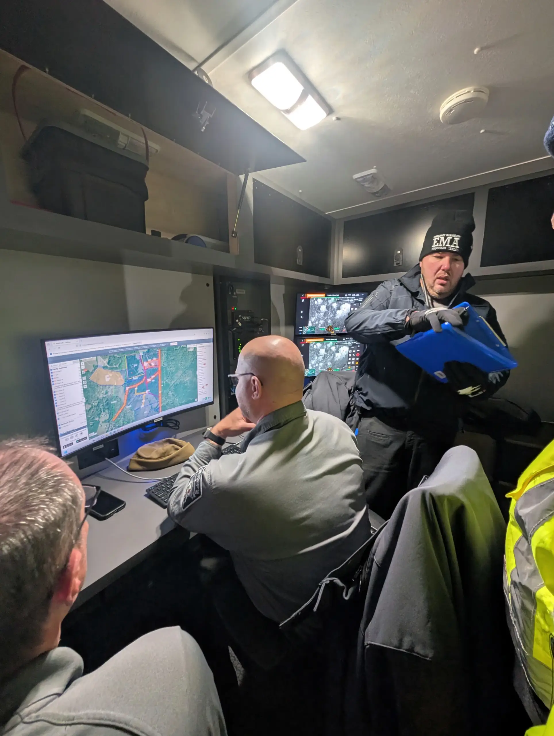
AGL captures clear, repeatable aerial and thermal documentation that provides decision-makers with a comprehensive visual overview of evolving conditions. When requested by authorized agencies or clients, this documentation supports situational awareness, records damage extent, and preserves visual evidence for recovery planning, review, and communication.
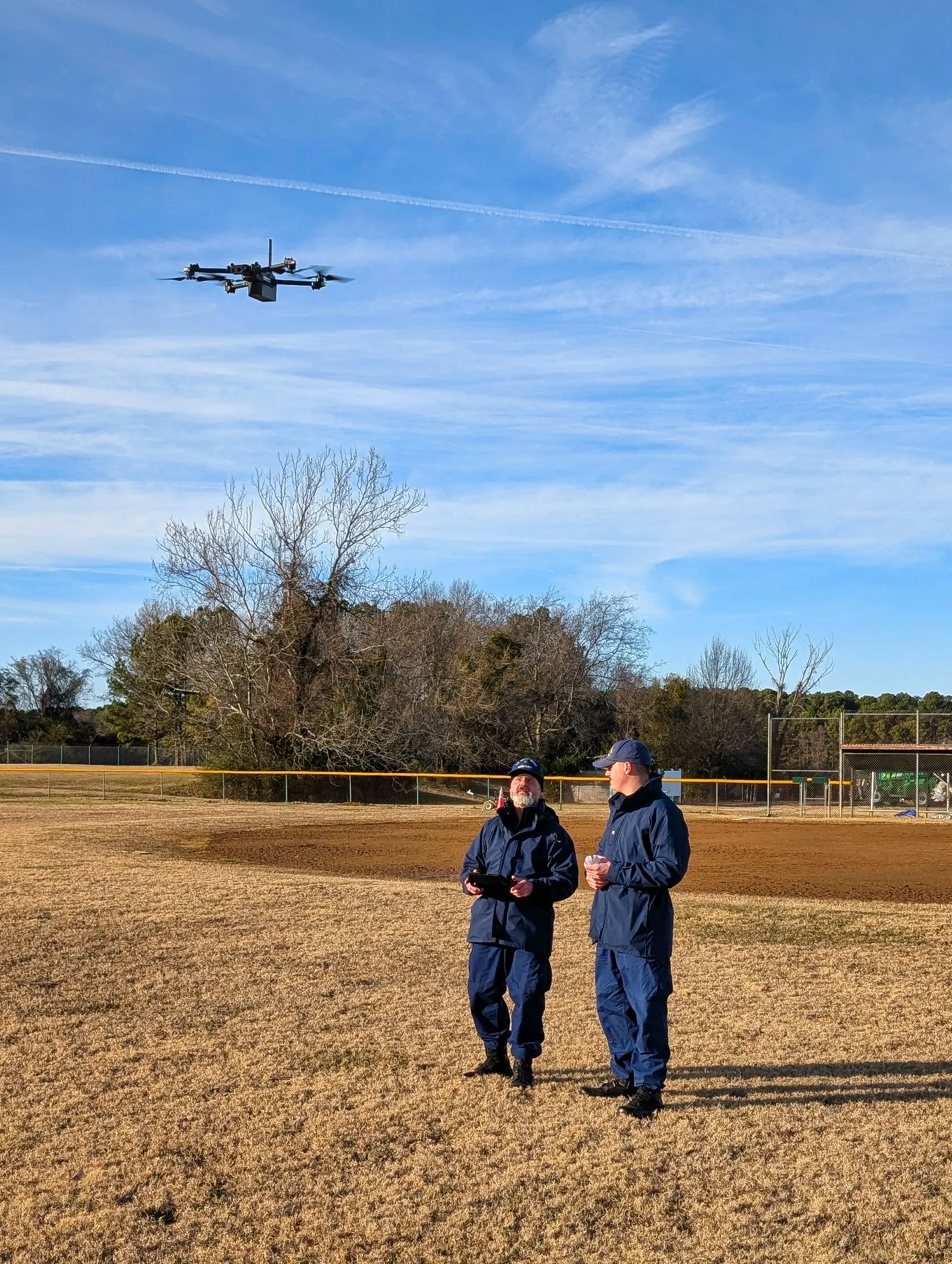
Operations prioritize safety, regulatory compliance, and reliable data capture. When working alongside public agencies, AGL integrates into established operational frameworks while maintaining a documentation-focused role that enhances clarity without interfering with command functions.
Operational Advantages
• Rapid aerial documentation without placing personnel in hazardous or inaccessible areas.
• Improved situational awareness through overhead, georeferenced imagery that supports planning and decision-making.
• Reduced operational risk by collecting visual data remotely instead of sending personnel into unstable environments
PUBLIC SAFETY & EMERGENCY SUPPORT
Does AGL Drone Imagery support public safety operations?
Yes. AGL Drone Imagery provides aerial documentation and coordination support when requested by public safety agencies. Services are designed to assist—not replace—agency operations.
How do you operate during emergencies?
AGL operates in coordination with local fire departments, law enforcement, and emergency management agencies. All operations follow safety protocols and applicable authorization requirements.
Can you respond quickly after disasters?
For disaster documentation, AGL can respond as soon as conditions are safe and authorized. Timing depends on access, airspace requirements, and weather conditions. Life-safety response is coordinated through public safety agencies—always call 911 first.
What types of public safety documentation do you provide?
Common support includes post-incident site documentation, large-area situational overviews, flood and storm impact visuals, and documentation for planning, review, or after-action reporting.
FACTS & FREQUENTLY ASKED QUESTIONS (FAQ)
1) What exactly does AGL Drone Imagery LLC do?
AGL Drone Imagery provides professional aerial photography, video, mapping, and 3D documentation designed to turn aerial imagery into clear, decision-ready information. Depending on your project, we deliver edited photos, edited videos, scaled site visuals, 3D models, elevation visuals, and documentation packages that help you plan, verify conditions, and communicate clearly.
2) How is this different from hiring someone who just takes drone photos or videos?
Most operators deliver good-looking footage. AGL focuses on repeatable, precise capture and professional processing workflows that improve consistency and usefulness, especially for construction, agriculture, and post-storm documentation.
3) What areas do you serve?
AGL Drone Imagery proudly serves Camden, Elizabeth City, Pasquotank, Currituck, South Mills, Gates County, Moyock, the Outer Banks, and surrounding northeastern North Carolina. Travel beyond the included service area is available as outlined in the Pricing Guide.
4) How does pricing work, and why is it shown as a range?
Pricing is shown as a range because every site is different. Final pricing is based on property size, obstacles, flight complexity, time on site, and FAA airspace authorization requirements.
5) What video format will I receive—horizontal or vertical?
You choose the format based on how you plan to use it. Horizontal video is best for websites, YouTube, and standard Facebook posts. Vertical video is best for Instagram Reels, TikTok, and Facebook Reels.
6) What deliverables will I receive?
Deliverables depend on the selected package and project goals and may include edited photos, edited video clips, cinematic videos, or advanced mapping deliverables. Raw photo and video files are available as optional add-ons.
7) How soon will I receive my deliverables?
Typical delivery timelines begin after the flight is completed. Photos and video clips are usually delivered within 5–7 business days. Cinematic videos typically take about 7 business days. Premium packages may take 7–10 business days.
8) What about FAA airspace authorization and scheduling?
Some locations require FAA airspace authorization before flight. Approvals can take up to three weeks, though many are completed within 5–10 business days. Flights are also weather-dependent.
9) Are your services legal and compliant in North Carolina?
Yes. All operations are conducted under FAA rules. AGL Drone Imagery provides aerial imagery and visual documentation services only.
10) Do your services replace licensed surveyors or engineers?
No. AGL Drone Imagery does not provide boundary determinations, legal property descriptions, certified measurements, engineering, or architectural services. Licensed professionals should be consulted where required.
11) How do I get started?
Call or text (252) 621-3006 or email info@AGLDroneImagery.com. We will discuss your goals, confirm scheduling and airspace requirements, and recommend the best deliverables for your project.
Start the Conversation
Call or Text: 252-621-3006
Email: info@agldroneimagery.com