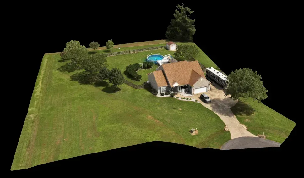
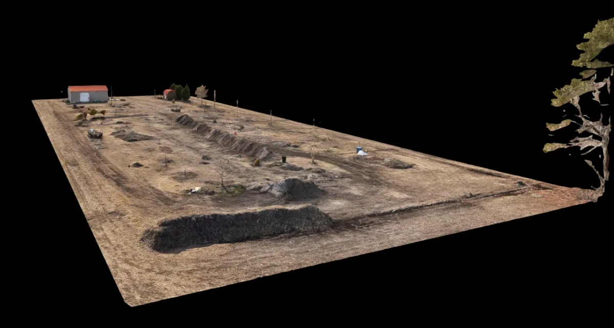
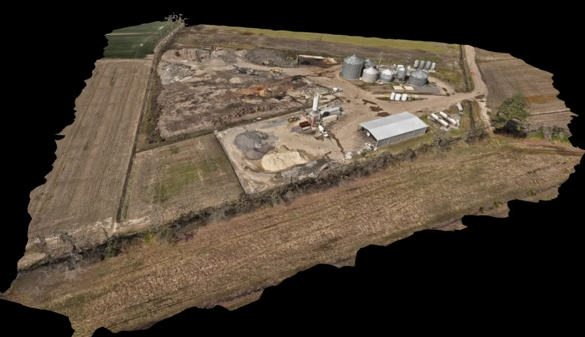
3D SITE
VISUALIZATION
Multi-angle aerial imagery processed into an interactive three-dimensional visual representation of a
property, structure, terrain area, or project site. This deliverable provides depth, perspective, and
spatial context beyond a flat overhead image and supports improved visual understanding of complex
environments.
Common Uses
• Construction and development progress documentation
• Industrial and commercial site visualization
• Property and infrastructure overview
• Terrain and elevation perspective visualization
• Roof, structure, and exterior documentation
• Planning, communication, and situational awareness support
This deliverable is provided for visualization, documentation, and reference purposes only and is not
intended for legal surveying, engineering certification, or regulatory determination.
Interact with 3D Models
Start The Conversation
Let's Solve Your Problem
From Above
Whether you need answers on a property, documentation for a project, or fast-response aerial support, AGL provides clear, actionable visual data to help you make decisions with confidence.
From thermal anomalies to site conditions and progress tracking, this is where we identify what matters and show you what others can’t see.
Call or Text: 252-621-3006
Email: [email protected]
Reducing Risk. Saving Time.
Delivering Clarity
Elizabeth City, North Carolina
Contact Us
License & Certifications
 Veteran-Owned Business
 FAA Part 107 Certified UAS Pilot
 FAA Airframe & Powerplant (A&P) Licensed
 FCC Licensed
 AGL Drone Imagery LLC does not provide licensed land surveying or certified measurement services.
- 🌡️ Level I UAS Thermography Certification – Infrared Training Center (FLIR)
- ⚓ U.S. Coast Guard Auxiliary – Remote Pilot in Command (Operational Support)
- DJI Enterprise Platform Experience (Matrice Series)
© Copyright 2026. All rights reserved. Website by Vareweb.