OVERVIEW
Public Safety & Emergency
Support
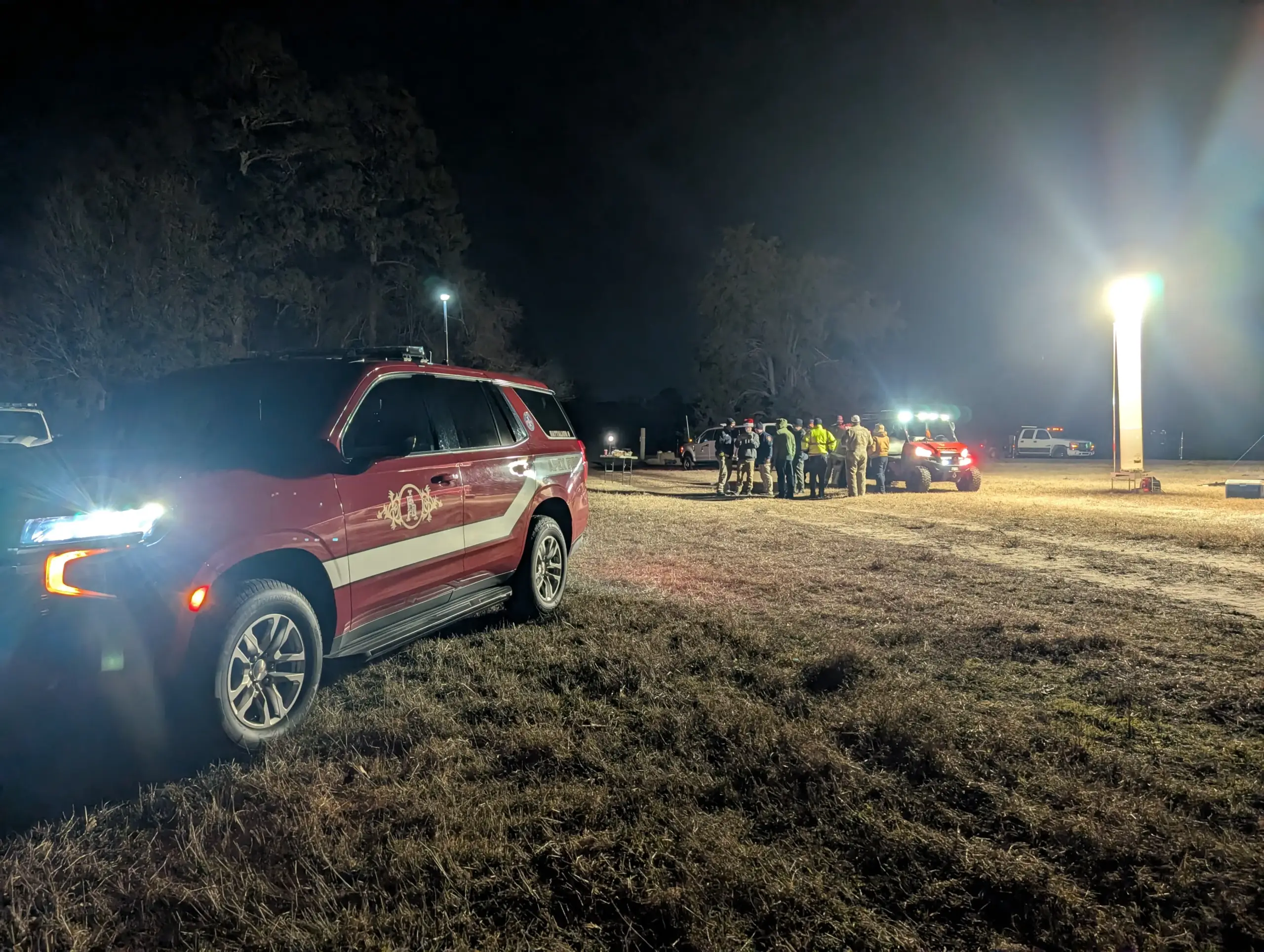
Aerial and thermal documentation supporting public safety operations, emergency response, damage assessment, search efforts, disaster recovery, and situational awareness for authorized agencies and organizations.
Important Notice:
If you are experiencing an active emergency, call 911 first. AGL Drone Imagery supports
authorized agencies and organizations through aerial documentation, situational awareness, training, and recovery support when requested. AGL does not assume incident command authority and operates within established emergency management and public safety frameworks.
THE PROBLEM
The Problem
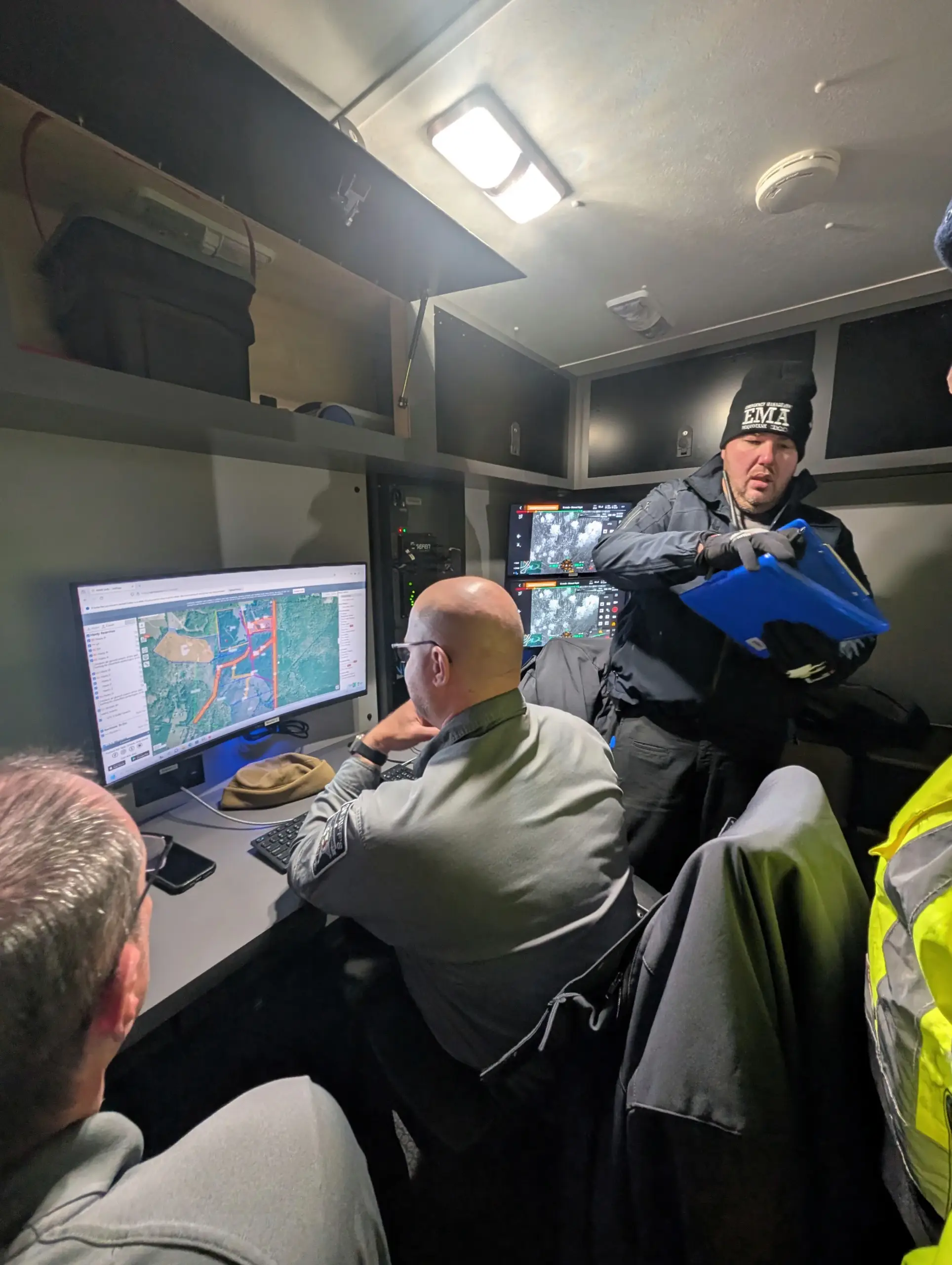
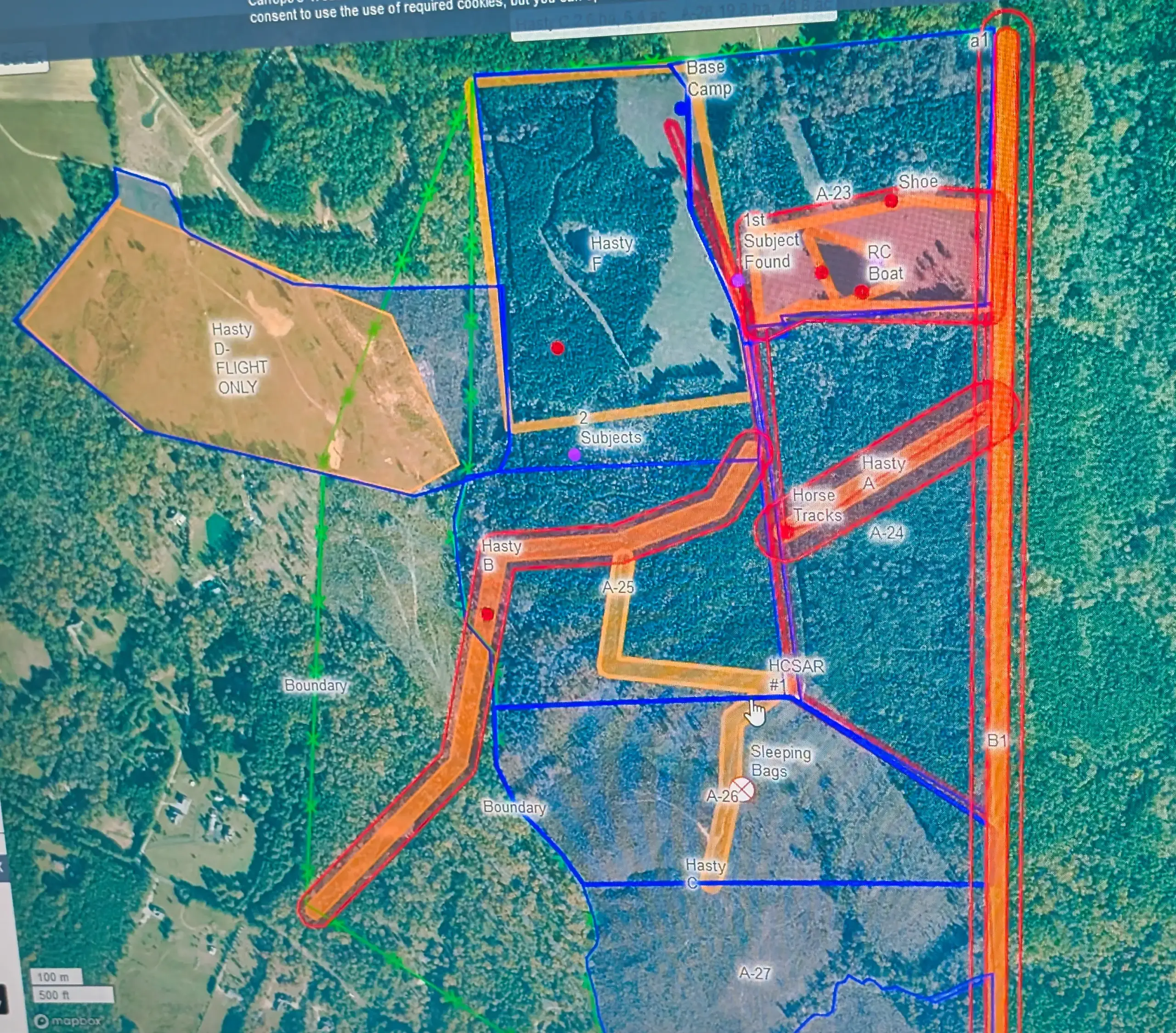
During emergencies, disasters, search operations, and critical incidents, decision-makers often have limited visibility of evolving conditions. Large search areas, damaged infrastructure, hazardous environments, and restricted access can delay assessments and increase risk to personnel. Without timely aerial information, agencies may spend valuable time gathering situational awareness before critical decisions can be made.
Solution
THE AGL APPROACH
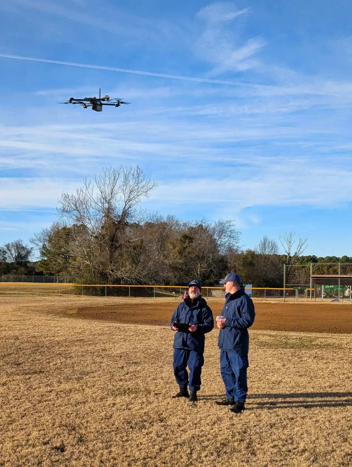
“Rapid Situational Awareness When It Matters Most” AGL provides aerial and thermal documentation that helps agencies quickly assess conditions, identify hazards, document damage, support search efforts, and improve situational awareness during emergencies and
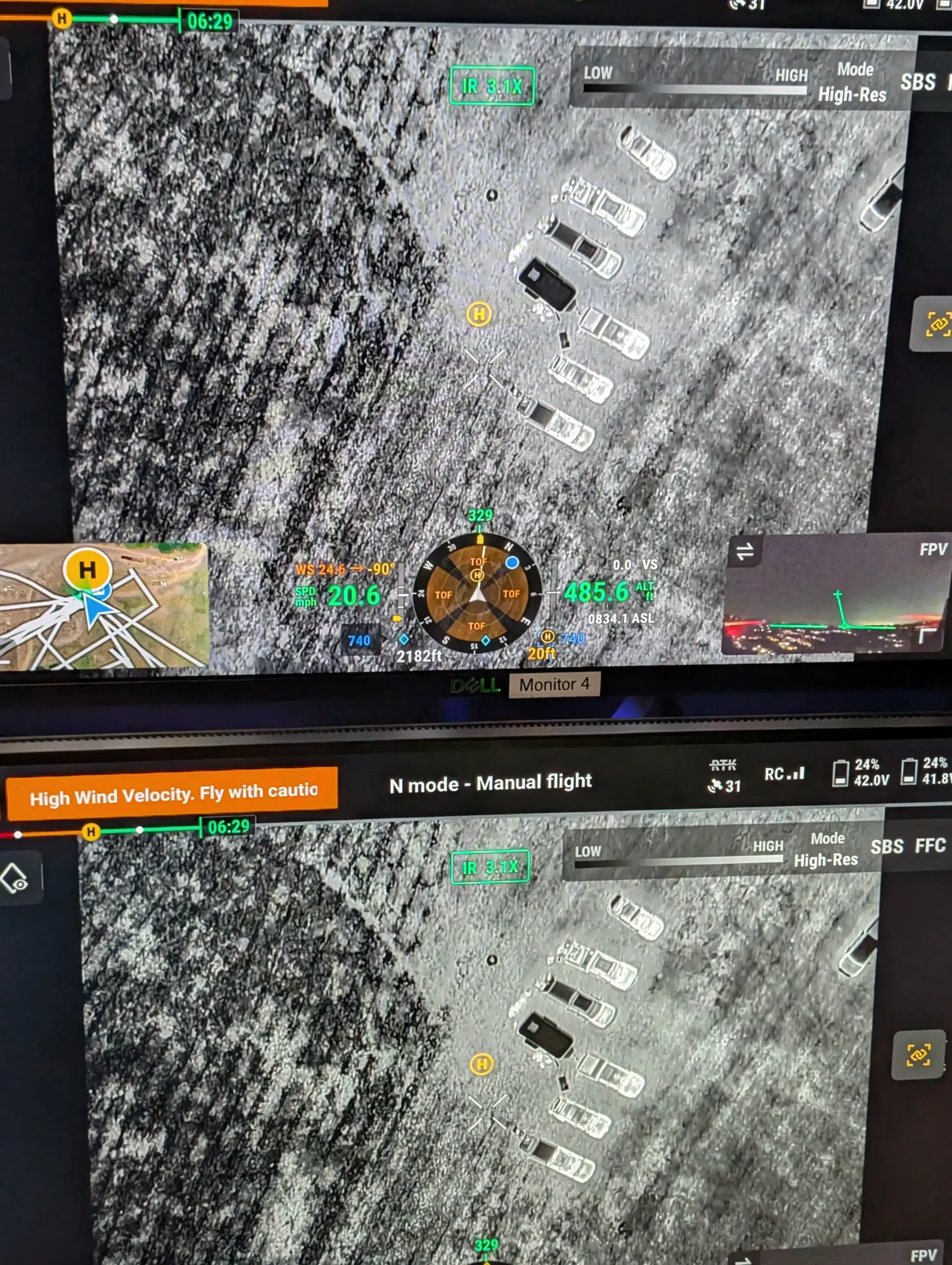
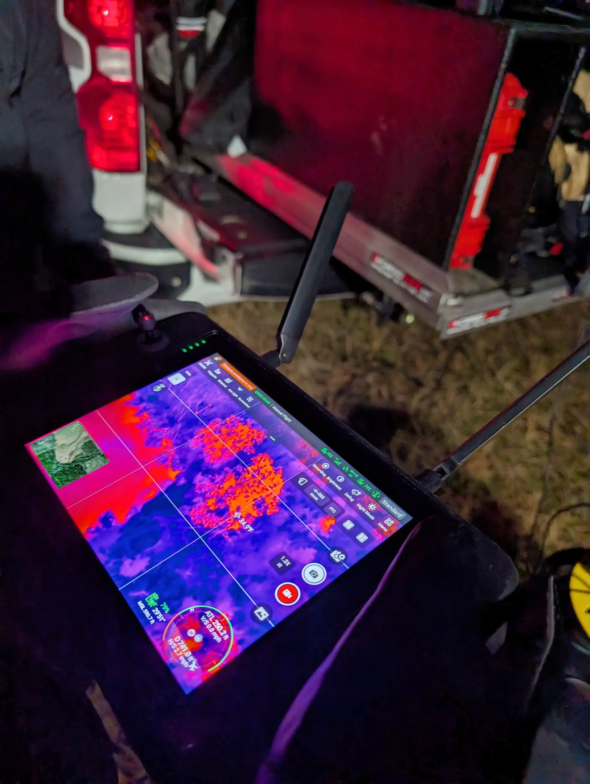
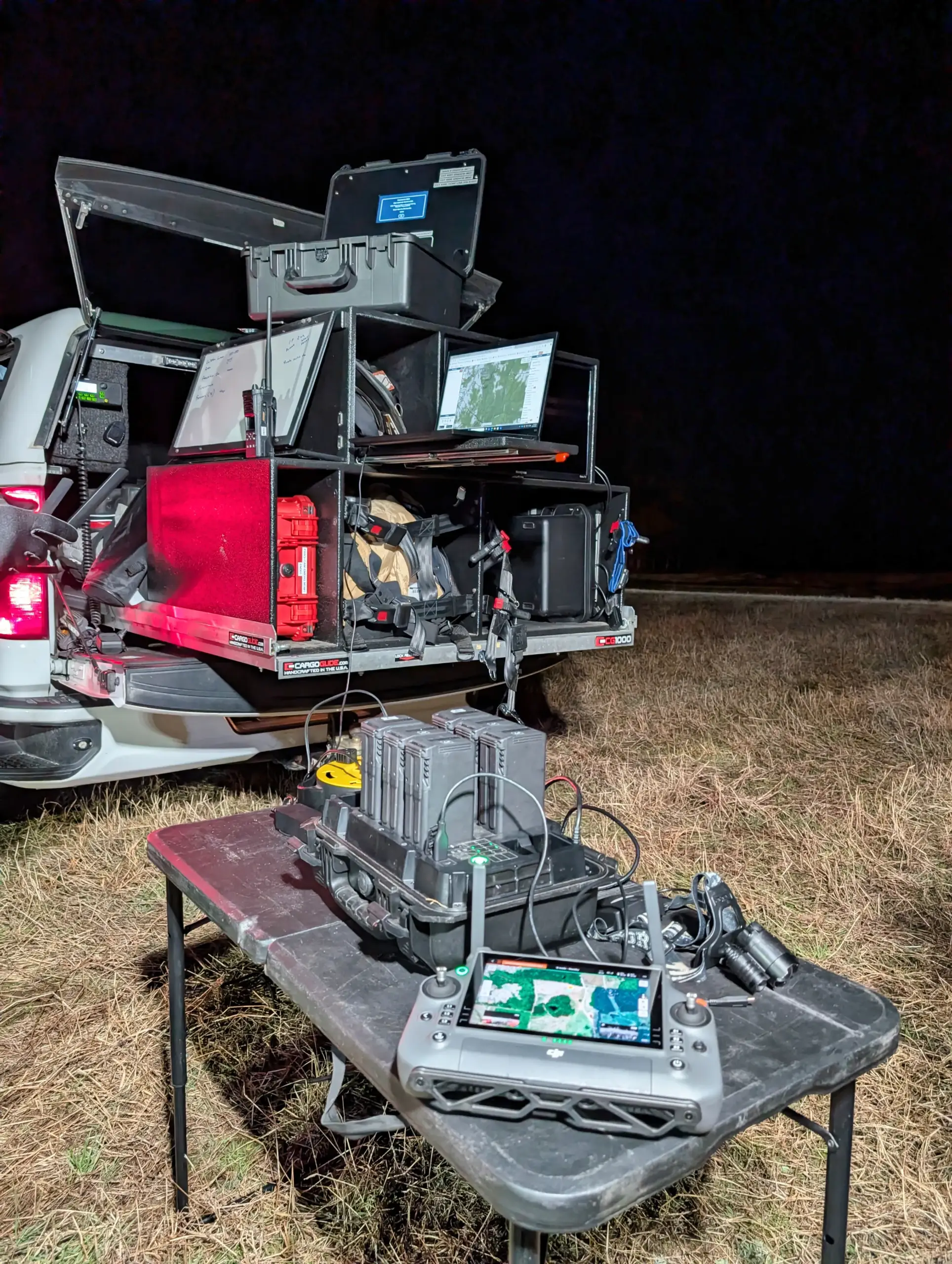
recovery operations. High-resolution imagery, thermal data, and repeatable documentation provide decision-makers with accurate information while reducing the need to place personnel in hazardous or difficult-to-access areas.
Working alongside authorized agencies and organizations, AGL supports emergency response, disaster recovery, training, operational planning, and after-action documentation through safe, reliable, and mission-focused UAS operations.
Operational & Safety Advantages
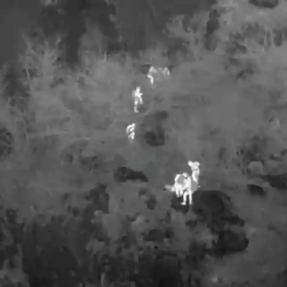
• Rapid aerial and thermal documentation supporting emergency response, disaster recovery, and search operations
• Enhanced situational awareness through overhead imagery, thermal data, and wide-area visual assessment
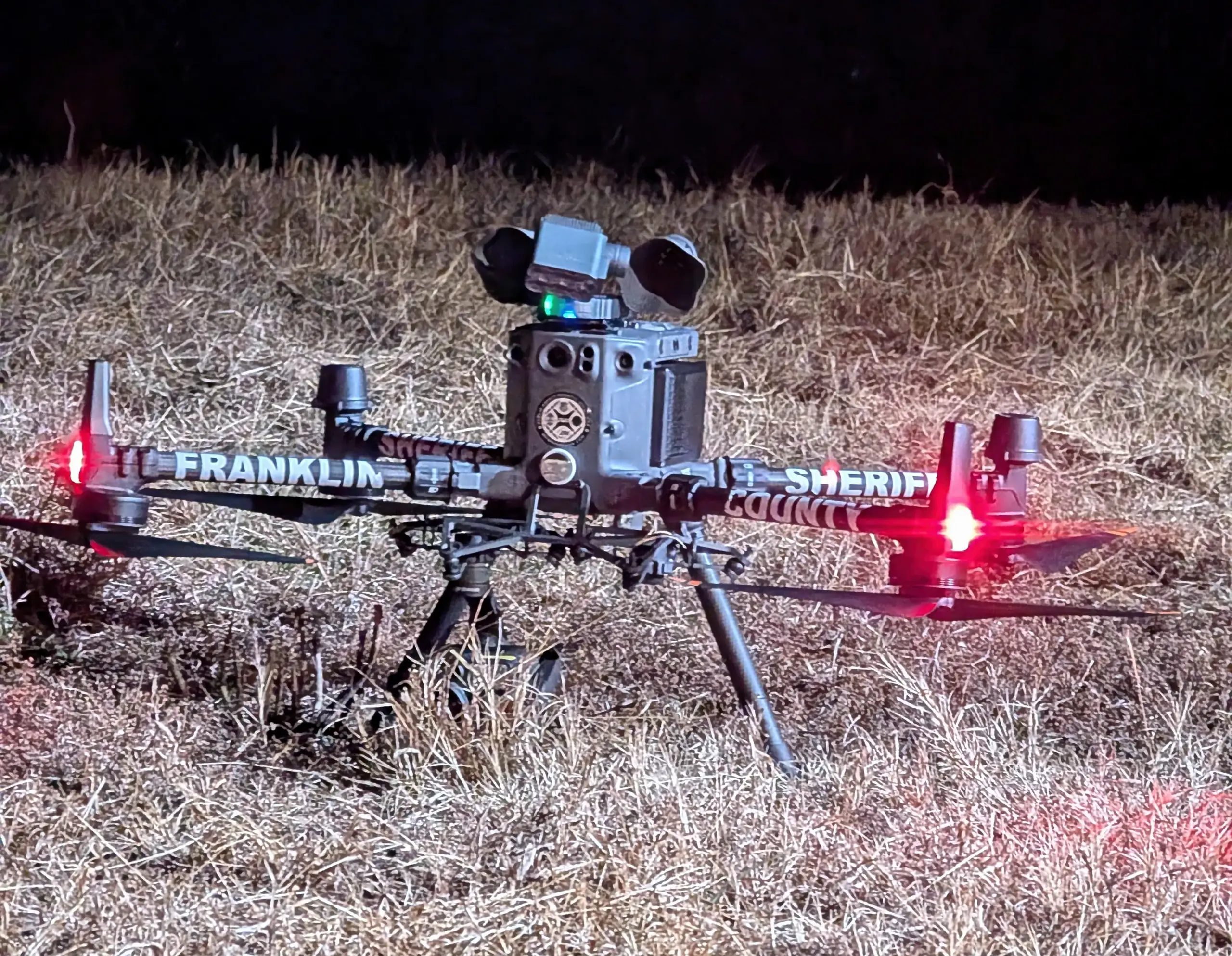
• Reduced personnel exposure to hazardous, unstable, or difficult-to-access environments
• Faster incident assessment supporting operational planning and decision-making
• Repeatable documentation for damage assessment, recovery operations, investigations, and after-action review
• Training, program-development support, and operational guidance based on real-world public safety UAS experience
Mission Deliverables
REAL-WORLD OPERATIONS
Mission Examples
Start the Conversation
PUBLIC SAFETY & EMERGENCY
SUPPORT
Does AGL Drone Imagery support public safety operations?
Yes. AGL Drone Imagery provides aerial documentation and coordination support when requested by public safety agencies. Services are designed to assist—not replace—agency operations.
How do you operate during emergencies?
AGL operates in coordination with local fire departments, law enforcement, and emergency management agencies. All operations follow safety protocols and applicable authorization requirements.
Can you respond quickly after disasters?
For disaster documentation, AGL can respond as soon as conditions are safe and authorized. Timing depends on access, airspace requirements, and weather conditions. Life-safety response is coordinated through public safety agencies—always call 911 first.
What types of public safety documentation do you provide?
Common support includes post-incident site documentation, large-area situational overviews, flood and storm impact visuals, and documentation for planning, review, or after-action reporting.
Let's Solve Your Problem
From Above
Whether you need answers on a property, documentation for a project, or fast-response aerial support, AGL provides clear, actionable visual data to help you make decisions with confidence.
From thermal anomalies to site conditions and progress tracking, this is where we identify what matters and show you what others can’t see.
Call or Text: 252-621-3006
Email: [email protected]
Reducing Risk. Saving Time.
Delivering Clarity
Elizabeth City, North Carolina
Contact Us
License & Certifications
 Veteran-Owned Business
 FAA Part 107 Certified UAS Pilot
 FAA Airframe & Powerplant (A&P) Licensed
 FCC Licensed
 AGL Drone Imagery LLC does not provide licensed land surveying or certified measurement services.
- 🌡️ Level I UAS Thermography Certification – Infrared Training Center (FLIR)
- ⚓ U.S. Coast Guard Auxiliary – Remote Pilot in Command (Operational Support)
- DJI Enterprise Platform Experience (Matrice Series)
© Copyright 2026. All rights reserved. Website by Vareweb.