OVERVIEW
Roofing & Exterior Documentation
-Visual and thermal documentation of roofs, building exteriors, solar installations, and elevated structures supporting condition awareness, maintenance planning, estimates, insurance records, and long-term property
documentation.

THE PROBLEM
The Problem
Accessing roofs, building exteriors, solar installations, and other elevated structures often require ladders, lifts, or specialized equipment. These methods can increase safety risks, consume valuable time, and still leave areas difficult to view, document, or monitor consistently over time
Solution
THE AGL APPROACH
“Safer Access. Better Visibility” AGL provides visual and thermal aerial
documentation of roofs, building exteriors, solar installations, and elevated structures without requiring routine ladder, lift, or rooftop access. High-resolution imagery and thermal documentation help property owners, contractors, facility managers, and insurers maintain
condition awareness, support maintenance planning, document property conditions, and create repeatable records over time.
These aerial perspectives provide safer access to difficult-to-reach areas while improving visibility, documentation quality, and long-term property records for residential, commercial, and industrial properties.
The Advantages
Improved safety, better visibility of hard-to-access areas, and stronger visual
and thermal documentation across residential, commercial, and large-scale properties.
TYPICAL DELIVERABLES & BENEFITS
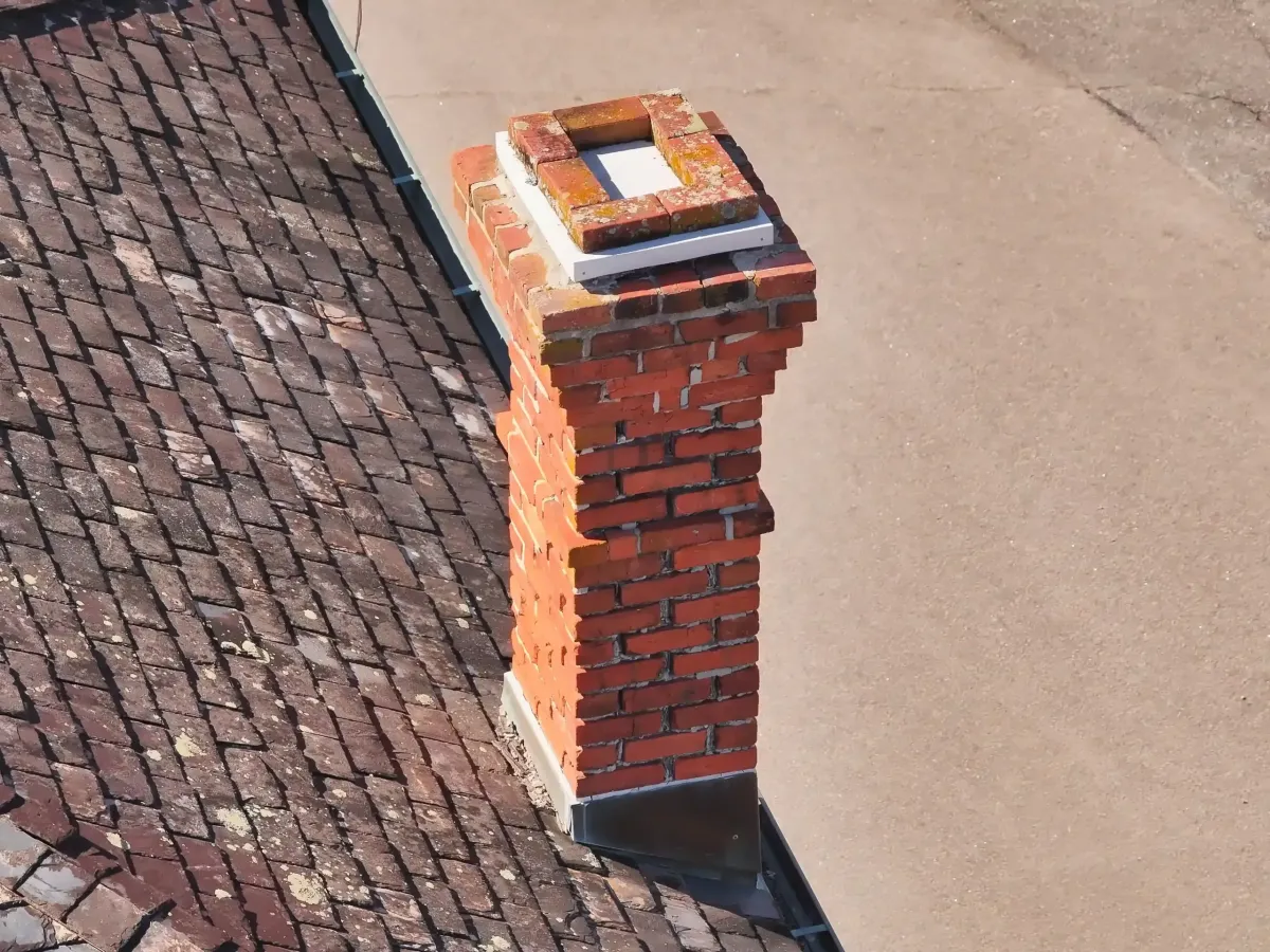
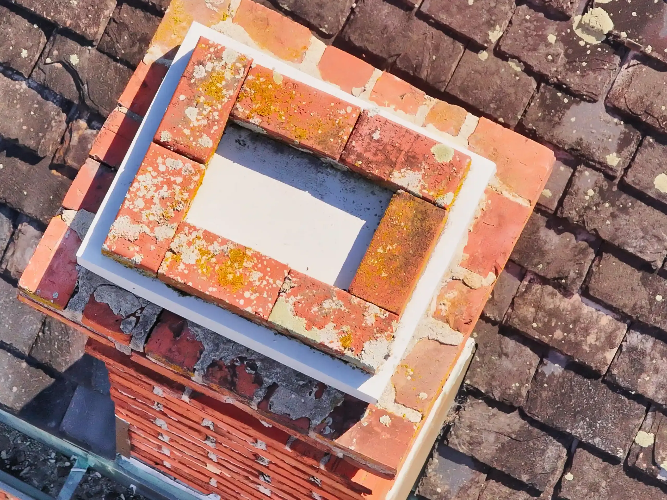
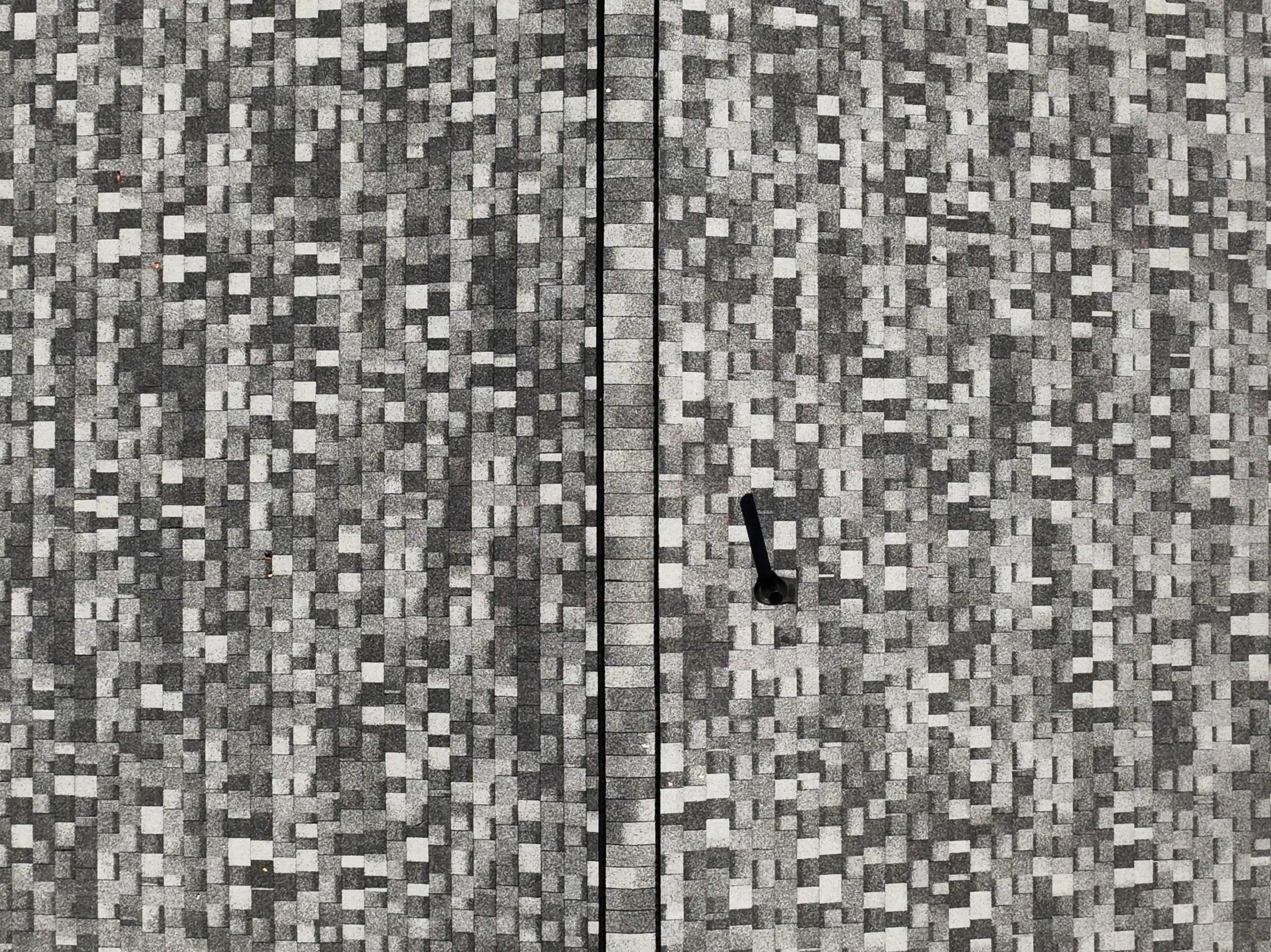
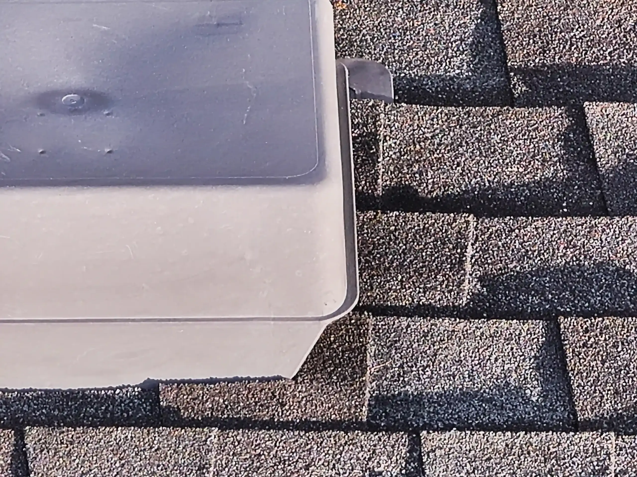
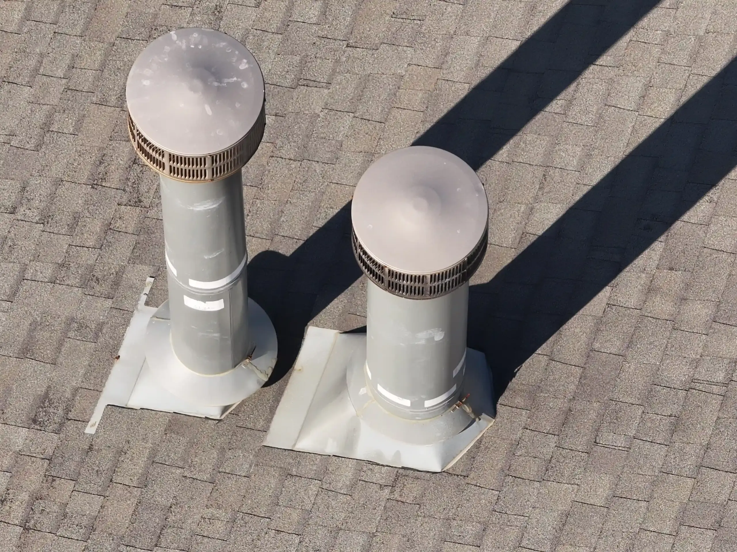
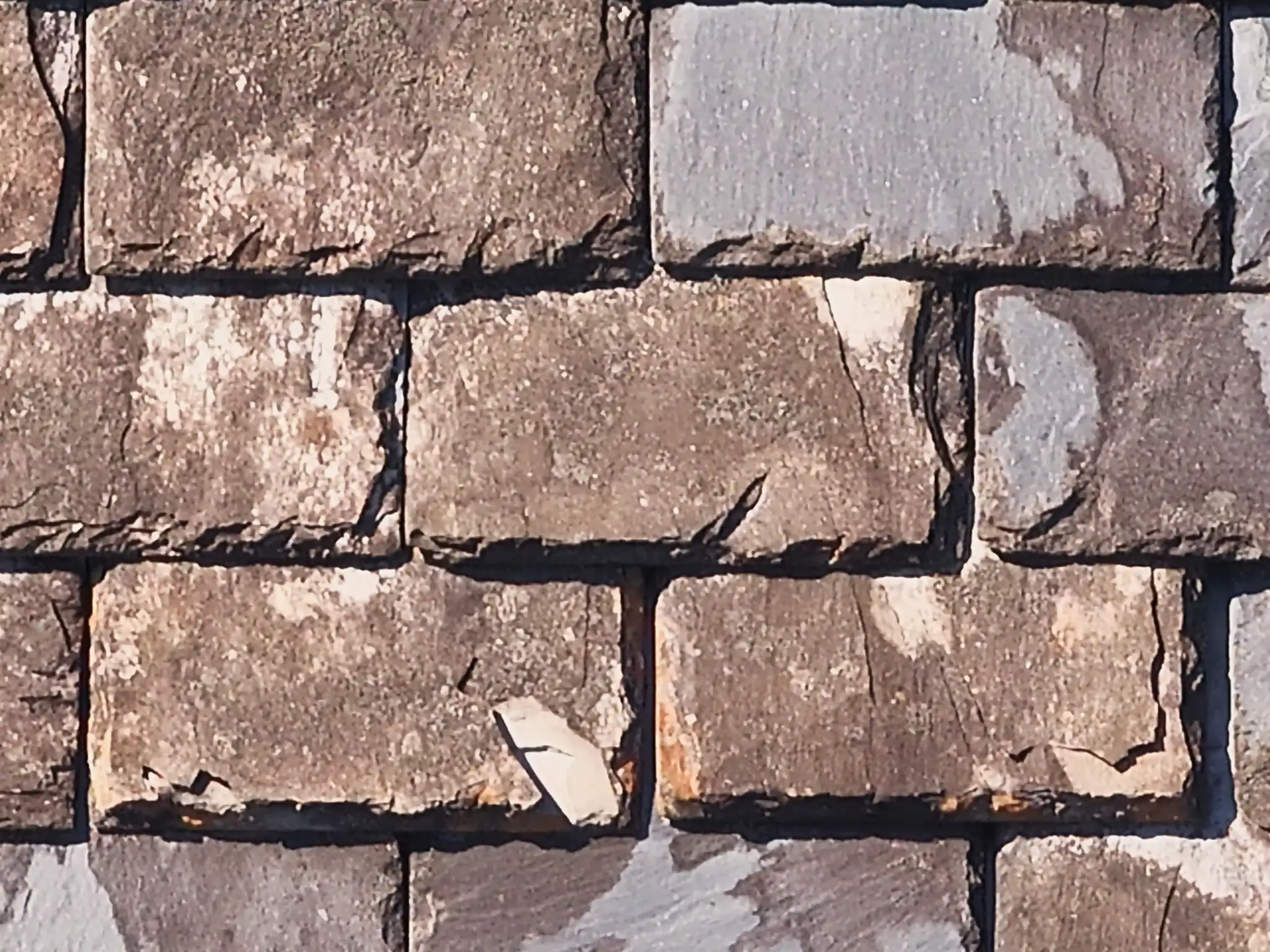
VISUAL PROOF
High-quality examples


Start the Conversation
Let's Solve Your Problem
From Above
Whether you need answers on a property, documentation for a project, or fast-response aerial support, AGL provides clear, actionable visual data to help you make decisions with confidence.
From thermal anomalies to site conditions and progress tracking, this is where we identify what matters and show you what others can’t see.
Call or Text: 252-621-3006
Email: [email protected]
Reducing Risk. Saving Time.
Delivering Clarity
Elizabeth City, North Carolina
Contact Us
License & Certifications
 Veteran-Owned Business
 FAA Part 107 Certified UAS Pilot
 FAA Airframe & Powerplant (A&P) Licensed
 FCC Licensed
 AGL Drone Imagery LLC does not provide licensed land surveying or certified measurement services.
- 🌡️ Level I UAS Thermography Certification – Infrared Training Center (FLIR)
- ⚓ U.S. Coast Guard Auxiliary – Remote Pilot in Command (Operational Support)
- DJI Enterprise Platform Experience (Matrice Series)
© Copyright 2026. All rights reserved. Website by Vareweb.